Click to view full size
Description
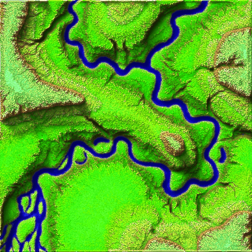
A simple experimental auto generated terain map 512 by 512 pixels. Contains a gray scale height map and a custom height map that extends the dynamic range from 0-255 to 0-765. All layers were computed from the stacked elevation map. (stacked means Red, Green< Blue channels are stacked (added) to give an elevation) Also includes is a normal map, occlution map, shadow map, river mask, and colour map. Combined.png is occlution, shadow, colour, and river mask images combined. The GreyScaleElevation.png is compatable with most terain editors I have tried it on.
From OpenGameArt
Model source and downloads
This page preserves searchable metadata and attribution. Use OpenGameArt for the current files and source details.
- Source creator
- Blindman67
- Source license
- CC-BY 3.0
Archived copies are shared under the license shown.
View/download on OpenGameArtMakes
See how others have printed this model
Likes
0Views
0Remixes
0